History Of The Road

“Drive the 10,000 miles across America and you will know more about the country than all the institutes of society and political science put together.” – Jean Baudrillard
NATIONAL HISTORY
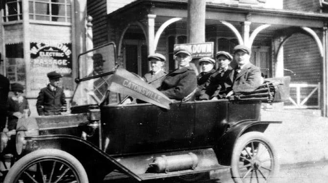
Beginning in Baltimore, Maryland the National Road crosses six states and more than 700 miles, past historic landmarks, forested mountains, fertile farmland and pastures, industrial towns and modern cities to the Mississippi River and the Eads Bridge in St. Louis, Missouri.
Alberty Gallatin, Secretary of the Treasury under Thomas Jefferson, developed the concept of the National Road, alternately now known as Route 40. Authorized by Congress in 1806, it became the nation’s first federally funded interstate highway opening up the country and facilitating America’s westward expansion.
In 1811, a contract was awarded to build the first 10 miles of road in compliance with strict requirements regarding the road’s width, surface and elevations. By 1818, the road had crossed Pennsylvania and western Virginia (now West Virginia) reaching as far as the Ohio River at Wheeling.

“There were sometimes twenty gaily painted four-horse coaches each way daily. The cattle and sheep were never out of sight. The canvas-covered wagons were drawn by six or twelve horses. Within a mile of the road the country was a wilderness, but on the highway the traffic was as dense as in the main street of a large town.”
Debate over the constitutionality of internal improvements served to delay extension of the road for several years. By the 1830s, the federal government had conveyed the responsibility for maintenance of the road to the states through which it runs. The National Road soon became a toll road as most of the states erected toll gates and toll houses to collect fees from those using the road.
As work on the Road progressed, a settlement pattern of towns and villages developed that is still visible to travelers today. The Road became Main Street in these early settlements, earning the nickname “The Main Street of America.”
Mile markers were an important component in early National Road travel. These markers lined the road serving to tell travelers how far they were from their destination and became an important icon in early National Road travel.
The 1840s were peak years for travel along the Road. Taverns and inns enjoyed brisk business and the National Road was celebrated in song, story, painting and poetry. Stage lines transported many famous persons along the nation’s “Main Street,” including presidents and future presidents, such as Monroe, Jackson, Polk, Taylor, Harrison, Fillmore, Van Buren, Buchanan and Lincoln, as well as notables such as Lafayette, Albert Gallatin, Henry Clay, Sam Houston, Daniel Webster, Davy Crockett, Chief Blackhawk, Jenny Lind, and P.T. Barnum. Huge Conestoga wagons hauled produce from frontier farms to the East Coast, returning with staples such as coffee and sugar for the western settlements.
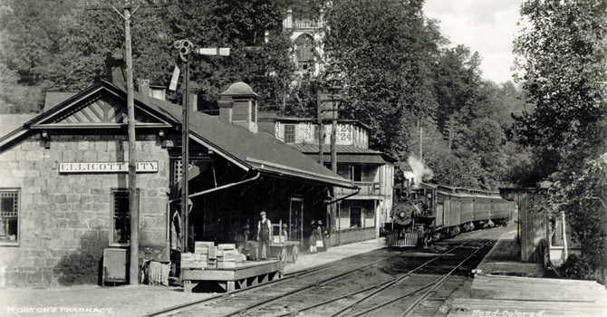
By the middle of the 19th Century, a new form of transportation, the railroad, overshadowed the National Road and the prominence and prosperity of the Road was overtaken by the “iron horse.”
Life along the National Road grew quiet for a time but all changed in the early 20th Century with the coming of the automobile and a new wave of touring in motorcars. Tourists driving the road stopped at many waysides to eat, to shop, and to sleep causing a new generation of travel and entertainment facilities to appear on the landscape to meet their needs – gas stations, restaurants, motels and tourist cabins, drive-in restaurants and drive-in theaters.
The Federal Aid Road Act of 1916, as the first federal highway funding law, established federal aid for highways as a national policy and was instrumental in extending and improving the country’s road system. The Federal Highway Act of 1921 provided for a national highway system of roads that would allow for transcontinental travel. Many roads including the National Road were realigned and incorporated as part of the U.S. Highway Ststem that changed named roads to numbered roads such as designating the National Road as U.S. Route 40.
Now, the new National Road, U.S. Route 40, is the busiest it has been since its heyday of the 1840s. However, instead of Conestoga wagons and stagecoaches, there are tractor-trailer trucks, buses and automobiles. Inns and taverns have been updated as restaurants, motels and hotels. The hustle and bustle of travel has returned to the Road.
The National Interstate and Defense Highways Act of 1956 served to create a limited-access interstate system. Interstate Highways 70 and 68 were constructed, and superseded U.S. Route 40 as the primary transportation routes through the region. U.S. Route 40 was bypassed and became a local, secondary, alternate, or, a scenic road.
The National Road was designated a National Historic Civil Engineering Landmark in 1976 and a State Heritage Park in 1994. It also earned the designation as a National Scenic Byway and All-American Road in 2002.
Maryland is one of six states that make up the entire Historic National Road corridor. The National Road Alliance is a consortium represented by each state’s byway management entity. Please visit the other five organizations websites for additional information and history on the Historic National Road.
 National Road Alliance Members:
- Ohio National Road Association – www.ohionationalroad.org
- Indiana National Road Association – www.indiananationalroad.org
- Pennsylvania – www.nationalroadpa.org
- Illinois – www.nationalroad.org
- West Virginia – www.historicwvnationalroad.org

